Technology
The most accurate and trusted weather data source in the world.
MeteoWeather has created a cloud-based platform and analytics tool from which images and analyses of satellite and other earth observation data are derived in real-time for business, science, and public policy.
Our Unique Technology
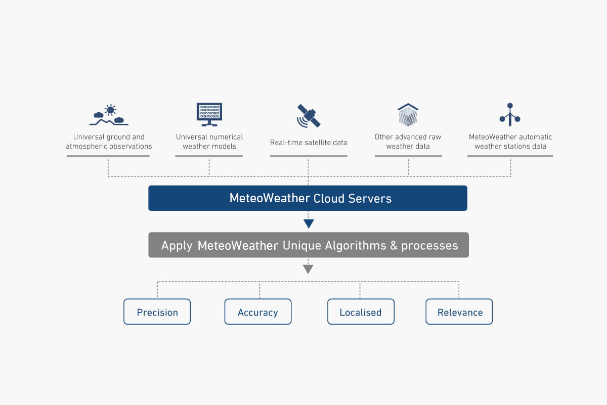
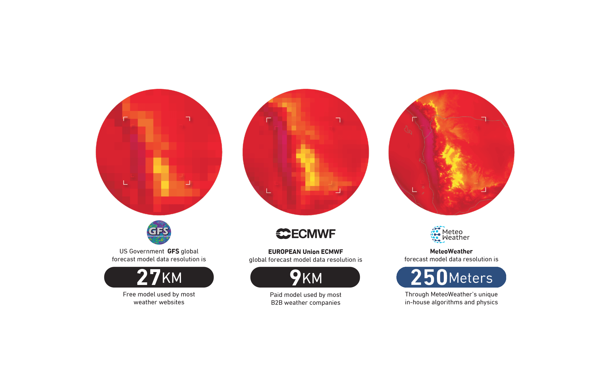
At MeteoWeather, we believe that outputs can only be as accurate as the information entered into them. Therefore, we strive to procure and accumulate only the best data from multiple sources, including universal ground and atmospheric observations, versatile numerical weather models, real-time satellite data, and MeteoWeather’s automatic weather stations. The data is then sent to our cloud-based servers for processing. Our our unique weather forecasting algorithms are then applied to process and generate accurate, localized, relevant, and precise weather forecast data. All system-generated weather forecast data are further enriched and quality assured by a talented team of professional meteorologists with a specialization in the MENA region.
Crystal
Our visualization & experimentation tool
- Cloud web-based visualization tool for NWP model data using stunning, customizable, and science-driven graphics.
- Real-time and highspeed data processing enables fast experimentation.
- Predefined map definitions and time series charts for all forecasters’ needs.
- Automatic and smart interpolation of data in time and space.
- Allows meteorologists to generate and save post-process weather equations that can mix, weigh and merge data, and provide new derived parameters.
Chronos
Monitoring tool
- Displays real-time observational data in map format.
- Archives, retrieves, and displays historical observational data.
- Provides time period display of historical data.
- Detailed reports for the selected stations.
- Time series plots of observational data.
GEOs
Geographical system and database
- Serves predefined geolocations with their details.
- Supports multilingual names, coordinates, time zone data, altitude, and their association administrative areas and countries.
- Supports search autocomplete.
- Supports geospatial queries.
Pinpoint
A meteorologist’s dream
- Provides the ability to develop new equations and turn them into ready-to-use forecast API instantly.
- Enables customization to enhance forecast.
- Integrates forecast overrides into the output.
- Supports time zones, elevation data, and auto-text forecast.
- Provides ready-to-use weather forecast for hourly segmented, daily views, and weather status.